Day 15 (1/15/20):
|
This morning we set off on the bus to the Quilotoa volcano. A local geologist, Dr. Theo Toulkeridis, is joining us for the day. It was great having Dr. Toulkeridis on the bus ride with us as he was able to comment on our surroundings as we drove to Quilotoa.
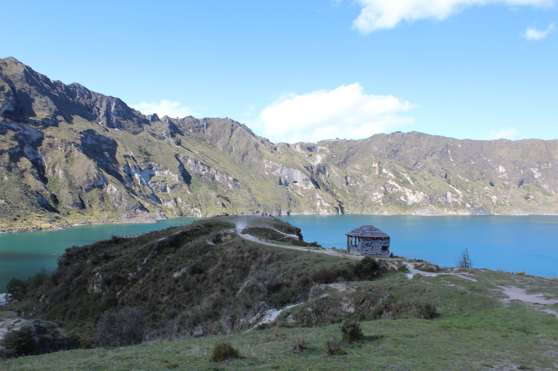
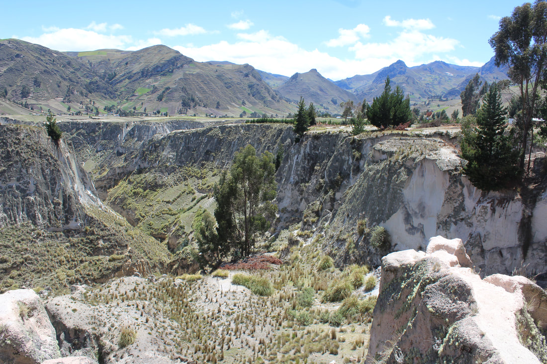
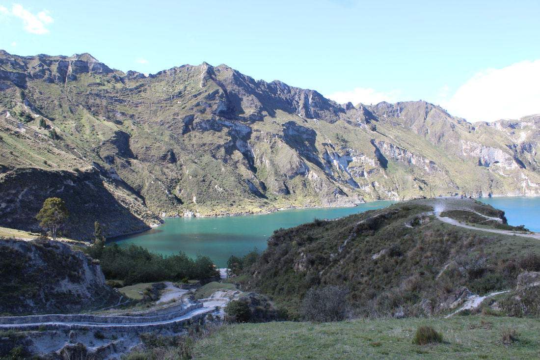
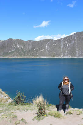
On the way to Quilotoa, we went to the highlands, Páramo region to see how a group of indigenous people live. As we pulled up to meet the indigenous family the first thing I noticed was the roof of their small home. The roof was very long and made of grass and straw tightly thatched together. They start a fire inside after the house is built so that the smoke will seal the straw and make the roof waterproof. Although the highlands can be windy and cold the houses they create with natural materials including adobe bricks help regulate the temperature year-round. Looking around the very small house I saw a loft and one mattress in the back. The kids sleep on the loft and I was shocked to hear that 4-5 people may share the mattress at one time. There are no windows in the house, just a door. The lack of windows caused the inside of the house to be very dim inside, however, there was one single light bulb hanging from the ceiling. This single light was the only use of electricity. One of the indigenous men who lived there showed us different types of potatoes that he grows on the land. In total, he farms twenty-five species. He showed about five different species to our group and I was only able to recognize one. Seeing the way these people live was a bit of a culture shock. This group of people was similar to the group we met in Saraguro yet very different. They had less modern facilities which made me contemplate how they complete seemingly simple tasks like showering or cooking. Dr. Toulkeridis noted that for things like medicine the use of medicinal plants is very popular in the countryside. Most houses have a small herb garden with medicinal plants. It was emotional seeing how little they seemed to have compared to all of us. Their way of life is simple and modern society is very complex. Perhaps living this way they experience some physical discomforts but the modern world always contains worries for the future and an obsession with material goods which are harmful to one's disposition. These people seemed happy (yes we were giving them money) but they seemed content with their small community and way of life. We also briefly stopped by Toachi Canyon. This canon was partially created by an eruption from Quilotoa many years ago. Quilotoa has not erupted in many years but there was a gas outburst in 1797. There is a lake in the volcano's caldera but it is not safe to swim in due to the gasses. The gas bubbles in the lake show that although this volcano may be considered inactive by some it is anything but. In fact, if a large gas bubble was to emerge from the lake, the surrounding area would be severely affected by its toxic gas. It is important to note that approximately 95% of the surrounding region’s population is composed of indigenous people. These groups would especially be at a disadvantage because even if there were some warning issued they most likely would not receive it. Arriving at Quilotoa I was surprised by how blue the water in the crater was. The experience of standing at the top of a volcano is something that I will never forget after this trip. It is thrilling to stand somewhere that is beautiful but also dangerous. I still can not believe that so many people live and work in such close proximity to an active volcano. The view from Quilotoa was very different in comparison to Pichincha and Sierra Negra. There was notably less vegetation at Quilotoa even though there is a lake. The time to hike down Quilotoa to the crater is about 30-45 minutes but the hike back up can take about 2 hours. This is due to how steep the crater is. I practically ran down the crater at some points involuntarily due to how steep the path was. I would not consider myself to be a very coordinated person and although I fell about four times I still made it! The view was beautiful and I was glad that I did not experience altitude sickness like I did at Cajas while visiting Quilotoa. To get back to the top of the volcano I opted to take a mule. Travel websites, my professor, and Dr. Toulkeridis all recommended using the mule, especially if one is a slow hiker, to keep up with the group. At first I was very excited about taking a mule since I’ve never even ridden on a horse before. Unfortunately, riding the mule back up Quilotoa was a terrible experience. I got on the mule with the help of a small child who I learned was 13 years old. I assumed an adult was about to show up to lead the animal back up the mountain but I was wrong. Two small children assisted Cass and I with our mules up the mountain. The kids had dirt on their faces and Cass gave them her extra water bottle as they did not have any water with them. I felt overwhelmed with guilt as these children ran alongside us ascending the mountain. My mule was not hit by the kids but Cass told me that they hit her mule a few times. I regret riding the mule but I know that if I did not take the mule back up the mountain I would have fallen behind the group and made everyone late. If I could redo this experience I definitely would have stayed at the top of the volcano and opted to not hike down. I had no idea that the mules were treated so poorly and if I had known I would not have ridden one. I was sure to give the children extra money for water for themselves and the mule but I still regret my choice. 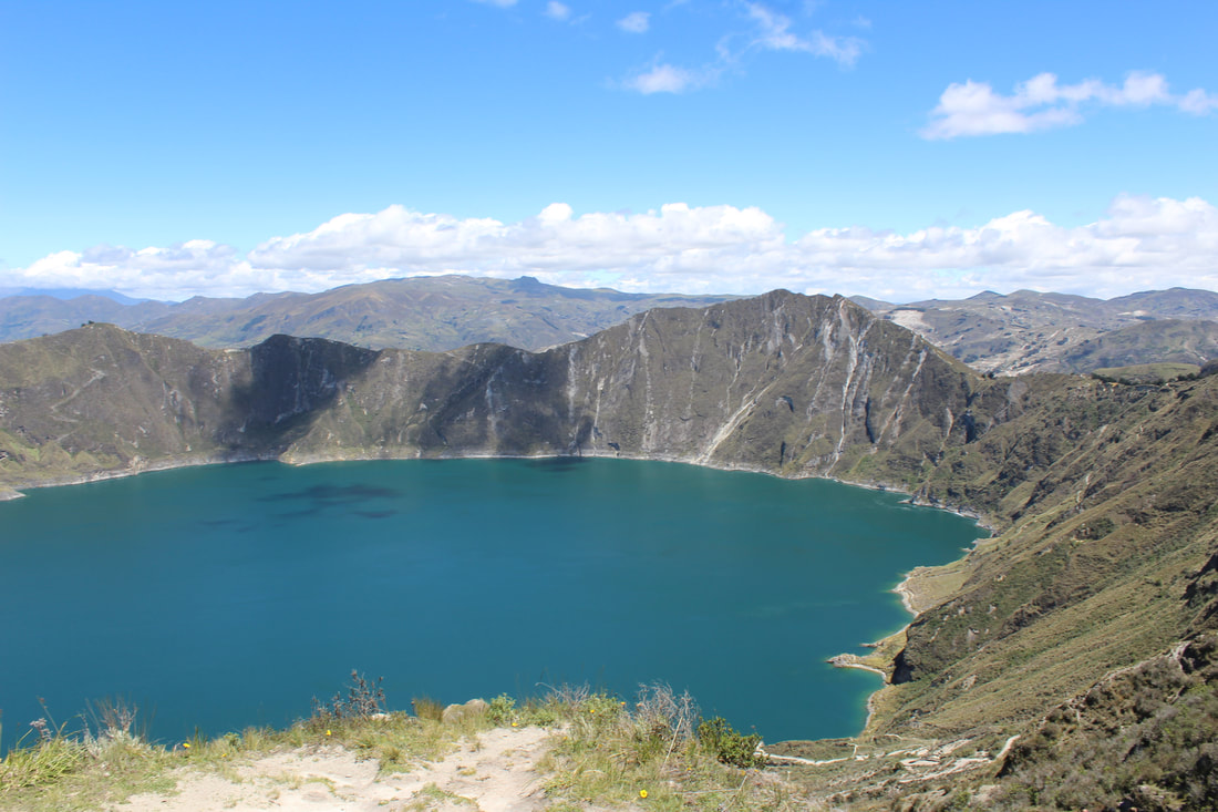
|
Later in the evening after returning from Quilotoa Dr. Toulkeridis gave a presentation about “Geodynamics, volcanology, and the evolution of life in Ecuador and The Galapagos”. He started off by discussing the 3 types of plate boundaries, diversion (subduction), conversion, and transformation boundaries. Even though Ecuador is smaller than Texas it has all 3 types of plate boundaries. Although the Galapagos Islands may be 1000km away from the coast of the mainland, seismic activity occurring around the islands is also responsible for some main land earthquakes in Ecuador. Conversely, eruptions on the mainland can affect the Galapagos. Reventador volcano is the second most active in Ecuador (on the mainland) and in 2002 there was a very large explosion, the ash which precipitated reached the Galapagos Islands.
Dr. Toulkeridis uses historical data of previous eruptions to predict when another eruption/seismic activity may occur. He noted that Quito typically has a large earthquake approximately every 100 years due to the mega fault line under the city. However, it has been 161 years since the last mega-earthquake. Even though this data exists, more than 99.8% of the structures in Quito are not seismic-resistant. He also explained how he proved the theory that mantle plumes are responsible for the formation of the Galapagos Islands. Dr. Toulkeridis examines historical data and ash from sediment to predict the timing and impact of potential eruptions. There is no exact scientific method to predict a volcanic eruption but Dr. Toulkeridis is more accurate than most with his predictions utilizing these methods. In fact he noted that there was an eruption in Ecuador a few years ago that local authorities underestimated and disregarded his advice. Those in charge of setting safety standards declared the threat of eruption over but Dr. Toulkeridis was correct in assessing the threat was not over because a volcano dome can implode and then explode so it may seem settled but is still volatile. At the end of his presentation he listed the top five most active volcanoes in Ecuador. The fifth most dangerous is Sumatra followed by Cuicocha lake, Quilotoa, Pululahua volcano, and finally Chalupas. Chalupas is the 9th most dangerous volcano on the planet. It is labeled as the 9th most dangerous since it is considered a “mega volcano” with the potential for a very destructive future eruption. Chalupas is a flat volcano and there are huge pumice deposits in a quarry nearby that indicate how the volcano will behave in the future. According to Dr. Toulkeridis, it will first erupt with a small explosion and then a much larger explosion will follow. After this smaller fractures will occur and in 5 hours Ecuador will disappear in ash. After 6 months this supervolcano explosion would result in a nuclear winter. In the U.S. Yellowstone has potential to cause widespread damage but not as severe as Chalupas. 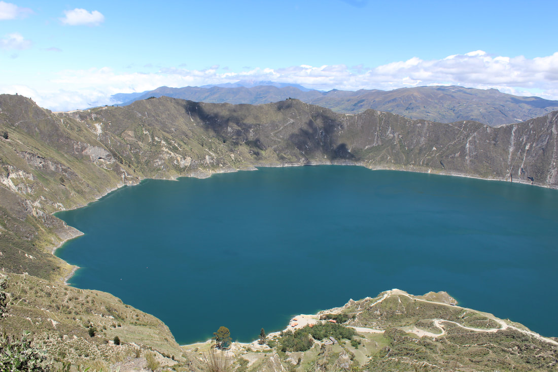
|
